
 As educators, we are constantly looking for ways to bridge the gap between abstract classroom concepts and real-world application.
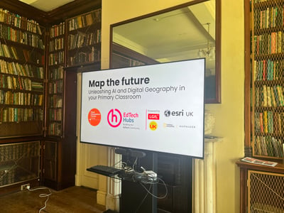
At a recent presentation hosted by the Royal Geographical Society (RGS), teachers and educational leaders from across the UK shared how they are transforming learning using Esri’s MapMaker.
What is MapMaker?
Esri MapMaker is a free, web-based digital mapping tool created with National Geographic for schools. It enables pupils to explore 2D/3D satellite maps, measure distances, overlay historical data, and track live geographic events without downloading software.
1. The Big Picture: Bridging the Geospatial Skills Gap
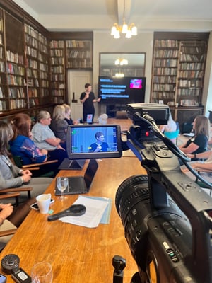 Opening the session, Dr Katie Hall highlighted why introducing spatial literacy early in education is critical for future generations:
"I’m here because of people who are missing... the faces that I don’t see in my professional life where I think they should be—faces that are missing from the geospatial industry."
— Dr Katie Hall
Katie emphasised that location-based data is the "hidden glue" behind modern infrastructure—from public transport and supply chains to climate action and hospital planning. Despite an 11% rise in demand for geospatial talent, supply is only growing by 2%, leaving rewarding careers unfilled.
Crucially for primary educators, Katie pointed out a striking finding from the 2025 Further Education Choices Survey: almost half of young people make their core career decisions while still in primary school.
"I was a teacher, and I never want to stand in front of teachers and ask them to do more, because I know that you already do more than enough. What I want to do is give you the tools that help you."
— Dr Katie Hall
Explore the MapMaker RGS event portal
2. Interactive Exploration in Practice
In a live demonstration, Kiaran Ratcliffe from Esri UK showed how MapMaker turns static geography lessons into active, inquiry-based investigations. By switching base maps, adding satellite layers, and using measuring tools, pupils can immediately grasp complex ideas like scale, land use, and physical landscapes.
-
Local-to-Global Thinking: Teachers start with familiar locations—such as the school field or local village—before zooming out to global phenomena like the River Nile or Mount Vesuvius.
-
Inquiry-Driven Learning: Rather than being told facts, pupils make observations, formulate questions, and analyse satellite imagery directly.
-
Inclusivity & Multilingual Maps: Switching base-map language settings allows English as an Additional Language (EAL) pupils to see their heritage languages represented on digital maps, fostering a deeper sense of connection and belonging.
3. Case Studies: How Schools Are Embedding MapMaker
Lawford Primary: Cross-Curricular Connections
At Lawford Primary, MapMaker was pilot-tested in Reception, Year 2, and Year 6 before being embedded across the entire school:
- History Integration: Year 4 pupils mapped Ancient Sumerian settlements along the Tigris and Euphrates rivers, visualising why early civilisations developed around fertile river systems.
- Maths in Context: Year 6 pupils used mapping tools during extended maths projects to measure real-world distances between cities and airports.
- Pupil Adaptability: Year 3 teachers noted how seamlessly pupils transitioned into custom classroom setups for science, art, and music lessons using flexible digital learning:
"The children have just naturally got used to it, and it's taken them less and less time to kind of settle into that format."
— Year 3 Teacher, Lawford Primary
Greystoke Primary: Enhancing Skills & Technical Accuracy
Greystoke Primary embedded MapMaker into their computing curriculum, giving pupils dedicated practice weeks to master digital skills before applying them in geography lessons:
-
Biomes & Climate: Year 5 pupils layered biome maps with transparency controls over terrain views to analyse climate zones relative to the Equator.
-
Historical Land Use: Using the Swipe tool, pupils compared historical maps with modern satellite imagery to track urbanisation and local development over time.
-
Real-World Problem Solving: Pupils designed proposed sites for a new sustainable classroom by combining physical trundle-wheel measurements with digital area calculations on MapMaker.
Exning Primary: Fostering Curiosity Across Key Stages
Celebrating its 150th anniversary, Exning Primary harnessed historical map overlays on touchscreen Chromebooks and iPads to bring the past to life:
- Live Earth Data: Pupils tracked real-time volcanic eruptions and earthquake data provided by National Geographic, bringing abstract plate tectonics directly into the classroom.
- Pupil Voice & 3D Exploration: Children praised the ability to switch seamlessly between 2D and 3D terrain views to visualise elevation:
"In 3D mode, you can see how tall the mountains are, how deep the water is... It's just better than paper."
— Arlo, Pupil at Exning Primary
"In MapMaker, it's easier when it's in 3D mode... an atlas is flat, and you can't see things inside the actual country."
— Amelia, Pupil at Exning Primary
Key Takeaways for Teachers
- Accessibility First: MapMaker runs directly in web browsers on touchscreens, Chromebooks, and iPads without requiring app downloads or paid subscriptions.
- Empower Inquiry: Use tools like measurement, transparency sliders, and live data layers to encourage pupils to "think like geographers".
- Connect the Curriculum: Combine map skills with history, science, and mathematics to create meaningful, real-world learning contexts.
See More Useful Takeaways at:
By giving primary pupils early access to professional-grade spatial tools, we aren't just teaching map skills; we are equipping them with 21st-century critical thinking skills and opening doors to future career possibilities.